Maps Page on Italy
Outline
- Physical Environment
- First map name
- Second map name
- Third map name
- Weather & Climate
- First map name
- Second map name
- Third map name
- Human Environment
- First map name
- Second map name
- Third map name
- Road maps
- First map name
- Second map name
- Third map name
- City Maps
- First map name
- Second map name
- Third map name
- Urban Transportation
Maps
- First map name
- Second map name
- Third map name
- Tourist Maps
- First map name
- Second map name
- Third map name
1 Physical
Environment
This
is a physical map of sea level
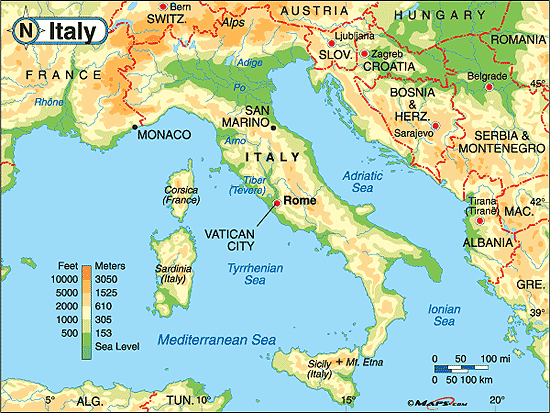
Physical map of Italy showing distance from sea level in feet or meters showed by colors.
Italy
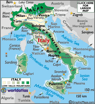
Map showing the physical landforms in Italy through color.
Stock
Photo- Italy, physical map, satellite view, map, 3d rendering
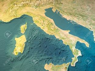
Satellite view of Italy showing land and water.
2 Weather &
Climate
Climate
map of Italy
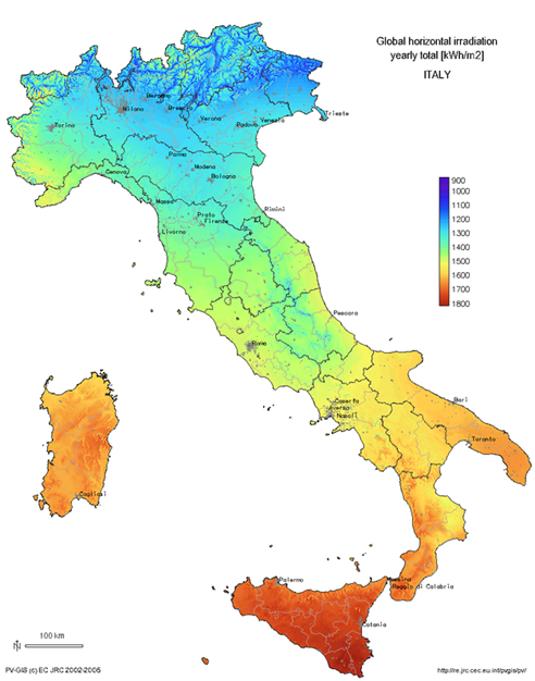
Climate map of Italy shown through colors.
Italy:
Climate
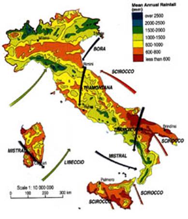
Map of Italy showing annual rainfall totals.
Average
Monthly Temperature- January
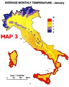
Average Temperatures in the month of January in Italy.
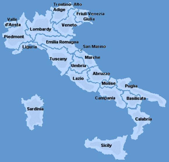
3 Human Environment
Map of
population density in Italy
_alt_colours.jpg)
Map of the population density of Italy in 2011.
Per
Capita GDP 2008- Italy
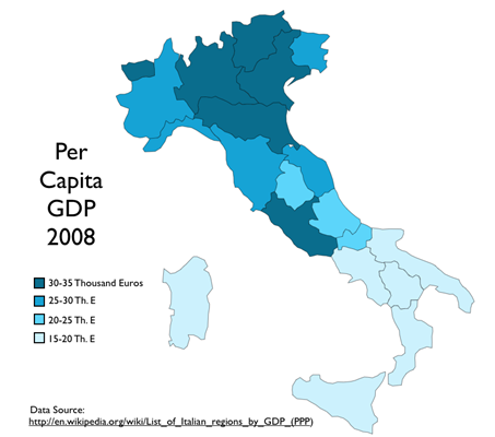
2008 per capita GDP in Italy.
Map of
the Italian Languages and Dialects
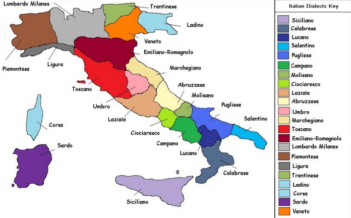
Map of the different dialects spoken in Italy.
4 Road Maps
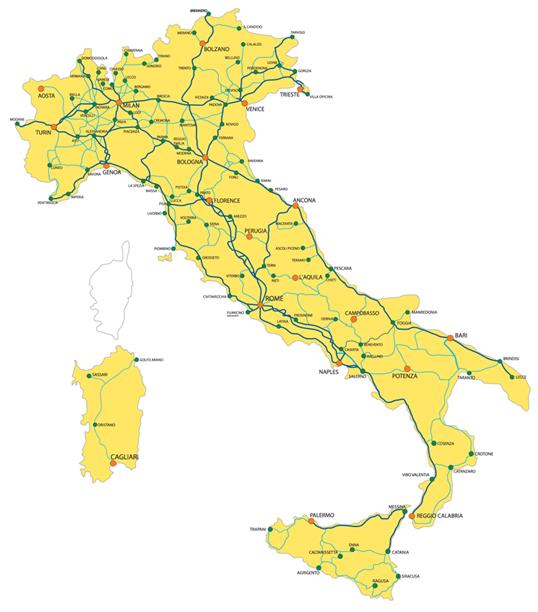
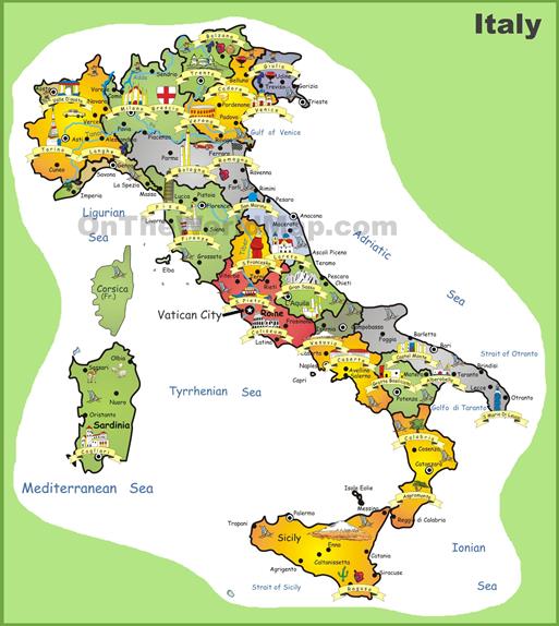
Italy
Map- Road Map of Italy
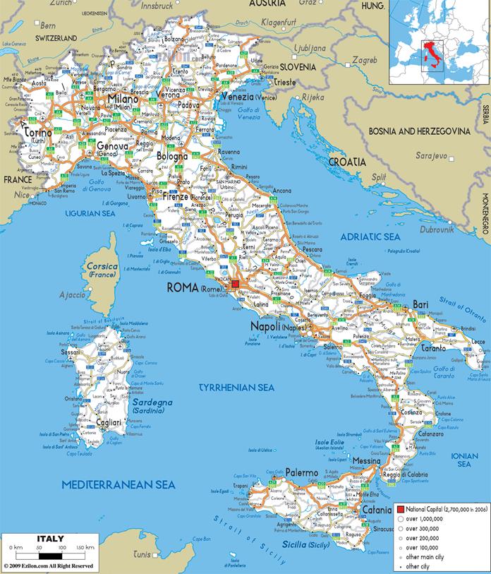
All roads shown in Italy and the populations of the areas they run through.
Road Map
of Italy
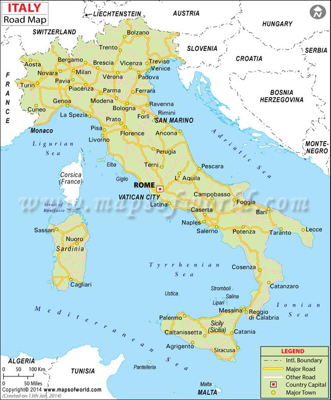
Different symbols showing what types of roads there are in Italy. Major towns and capitals also included.
Small
Road Map of Italy. Italy Small Road Map.
Map showing all of the small roads in Italy.
5 City Maps
Map of
Milan City, Italy
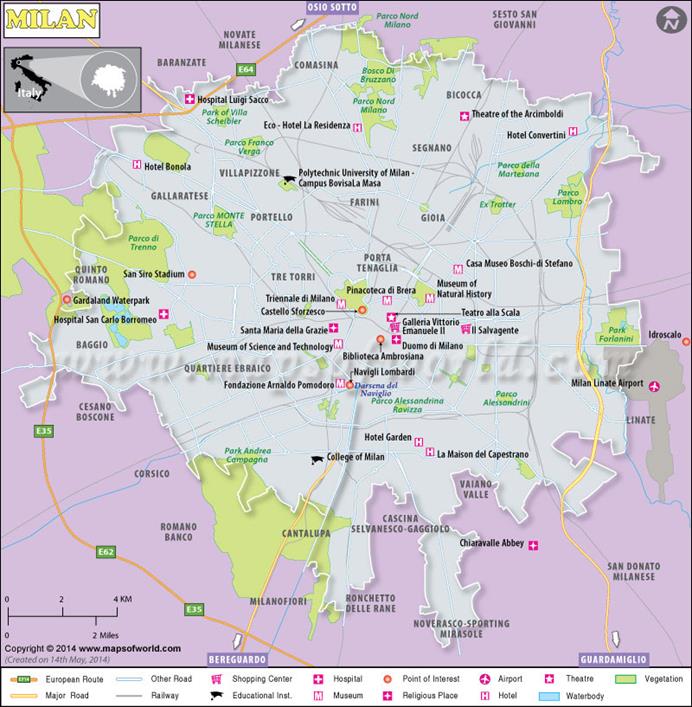
City map of Milan showing landmarks through different symbols on what they represent.
Map of
Rome
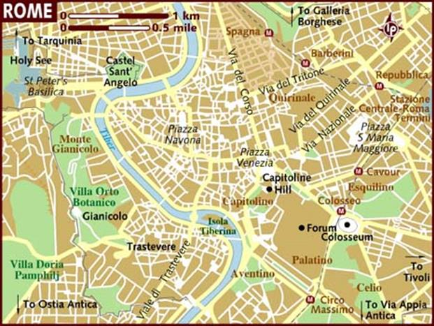
Map of Rome showing the names of landmarks.
Map of
Venice
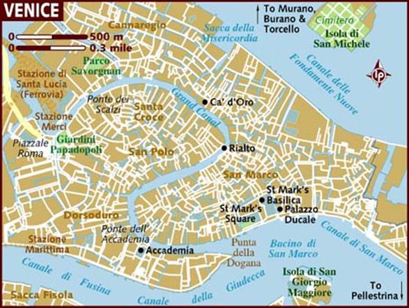
City map of Venice showing roads, cities, and landmarks.
6 Urban
Transportation
Most
important metro stations
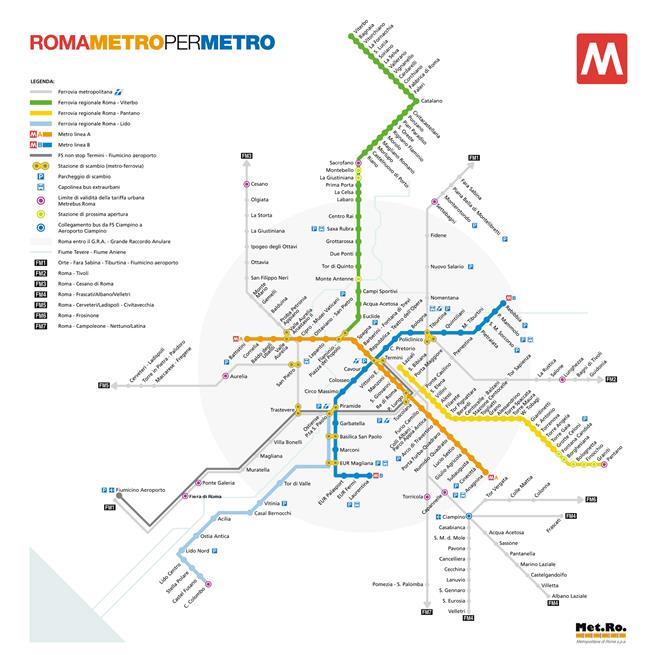
Metro stations in Rome showing the routes in colors.
Train
routes in Italy
Map of the different train routes in Italy shown in colors and destinations.
Milan
metro map
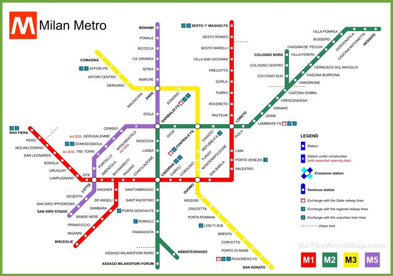
Map showing the Metro routes in Milan through colors and including the stops,
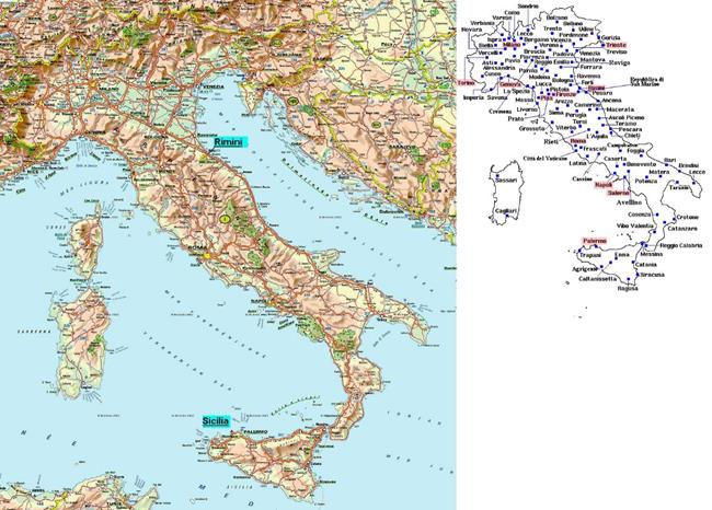
7 Tourist Sites
Italy
Map Tourist Attractions Photo Gallery
Map showing tourist attractions with pictures of what those attractions are.
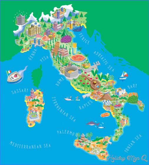
Italy
Tourist Map
Tourist map showing the city names and symbols on what the attractions are.
Map of
Italy, Tourist Places in Italy
Map showing Italy’s attractions in different regions.
Submitted
by Sarah Hunt on March 1, 2019.